Ascension du Sassopiatto

libertju
User

Length
8.1 km

Max alt
2918 m

Uphill gradient
895 m
Km-Effort
20 km

Min alt
2051 m

Downhill gradient
895 m
Boucle
Yes
Creation date :
2018-08-19 08:46:25.27
Updated on :
2018-08-19 08:46:25.27
3h52
Difficulty : Difficult

FREE GPS app for hiking
 SityTrail
IGN / Geographical institutes
SityTrail Plus
The world is yours!
About
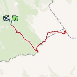
Trail Walking of 8.1 km to be discovered at Trentino-Alto Adige/Südtirol, South Tyrol, Kastelruth - Castelrotto. This trail is proposed by libertju.
Positioning
Country:
Italy
Region :
Trentino-Alto Adige/Südtirol
Department/Province :
South Tyrol
Municipality :
Kastelruth - Castelrotto
Location:
Unknown
Start:(Dec)
Start:(UTM)
705987 ; 5154798 (32T) N.
Comments